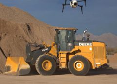
The commercial unmanned aerial vehicle (UAV) market is expected to hit $6.4 billion globally by 2020, much of which is driven by the power of the aerial data drones provide. Drone technology has reached a level of simplicity and a price point that enables almost anyone to get a bird’s eye view of a project, creating digital maps with powerful tactical applications across industries.
During the past few years, the UAV market has focused on affordably and reliably getting drones in the air to map a site. With that problem now solved, the industry is turning its focus to the task of putting that data to use.
One of the most interesting and popular applications for aerial drone data is monitoring change over time, a use case that depends entirely on being able to precisely align data sets across multiple surveys. Creating a simple process to ensure UAV data is precisely aligned from flight to flight is the industry’s next big challenge.
A UAV-created map will always be flawed for two reasons:
1. Inherent error in GPS creates slightly inaccurate location metadata for each photo.
2. Photogrammetry uses a best-fit process that introduces additional error when stitching photos into a map.
The end result is that every time you fly a site, common objects will have different latitude and longitude positions on different maps. How to overcome this error is currently a hot topic of debate across the drone world.
Improving UAV Mapping Accuracy
Many people advise trying to improve accuracy at the time of flight with additional hardware, like using ground control points and precision GPS (global positioning system) sensors.
These options work well for certain situations, but have a number of drawbacks: they’re costly, time-consuming, still contain error, and only work at the time of capture. Essentially, you’re paying more money to still have imperfect results, and you won’t be able to correct any previous surveys. Software provides a simpler solution.
Software solves the precision problem by allowing the user to mark known features on their maps and then match them across surveys. With this process, the software can correct for the inherent error in the drone’s GPS system by aligning the maps to correspond precisely to one another, or with known points on a global coordinate system.
Having a simple, cost-effective view of change over time provides invaluable projects insights that drastically improve productivity and decrease costs. These insights, however, are completely dependent on the end user’s ability to create precise maps every time they fly.
As drone GPS hardware becomes cheaper and more accurate, this problem will become simpler, and we’ll be able to do even more with the data. For the present, however, we think it makes the most sense to overcome this hurdle with some simple post-processing. It lets you fix precision on your old maps, and fly more with less work and less hardware.
Brian Saab is the cofounder and CEO of Unearth Technologies. This piece first appeared in Today’s Construction & Tech Trends.

